HomeAbout...New userMapsInstructionsStatistics
✕
Init › Maps › Cities › Barcelona
🏙 Cities · Created by: Charly 4 8 15 16 23 42 EXECUTE

Barcelona

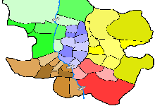
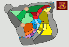
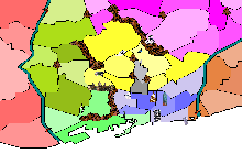
Barcelona is organized into 10 administrative districts comprising 38 neighborhoods: Ciutat Vella with the Gothic old town and El Raval; Eixample with its Cerdā grid of octagonal blocks; Sants-Montjuīc with Montjuīc Park and the port; Les Corts with Camp Nou; residential Sarriā-Sant Gervasi; Grācia with its bohemian squares; Horta-Guinardķ on the slopes of Tibidabo; Nou Barris in the north; industrial Sant Andreu; and Sant Martí with the 22@ technology district. The districts of Nou Barris, Ciutat Vella, and parts of Sants-Montjuīc have the highest levels of residential vulnerability and risk of social exclusion, while areas of Collserola such as Vallvidrera and Horta have a higher risk of wildfires. In this urban Risk, Ciutat Vella is the historic central hub but is vulnerable, Eixample is the central corridor connecting all districts, Montjuīc is an elevated fortress with panoramic views, and 22@ in Sant Martí is a strategic economic territory. Controlling access from the port, Sants railway station, and the Ronda de Dalt and Ronda del Litoral ring roads gives you a logistical advantage for dominating the city.
⚔

Your next conquest starts here

Log in with your account or sign up for free to play on this map and over 100 more

Play nowI don´t have an account yet, I want to sign up
Barcelona
🔍
CategoryCities
PLAYERS3 to 6
AccessRestricted
Regions8
territories48
Explore more similar maps
✕


CompeticionRisk
SINAíSTRATEGOCOLDITZAJEDREZ
HomeAbout...New userMapsInstructionsStatistics
✕
Init › Maps › Cities › Barcelona
🏙 Cities · Created by: Charly 4 8 15 16 23 42 EXECUTE

Barcelona

Barcelona is organized into 10 administrative districts comprising 38 neighborhoods: Ciutat Vella with the Gothic old town and El Raval; Eixample with its Cerdā grid of octagonal blocks; Sants-Montjuīc with Montjuīc Park and the port; Les Corts with Camp Nou; residential Sarriā-Sant Gervasi; Grācia with its bohemian squares; Horta-Guinardķ on the slopes of Tibidabo; Nou Barris in the north; industrial Sant Andreu; and Sant Martí with the 22@ technology district. The districts of Nou Barris, Ciutat Vella, and parts of Sants-Montjuīc have the highest levels of residential vulnerability and risk of social exclusion, while areas of Collserola such as Vallvidrera and Horta have a higher risk of wildfires. In this urban Risk, Ciutat Vella is the historic central hub but is vulnerable, Eixample is the central corridor connecting all districts, Montjuīc is an elevated fortress with panoramic views, and 22@ in Sant Martí is a strategic economic territory. Controlling access from the port, Sants railway station, and the Ronda de Dalt and Ronda del Litoral ring roads gives you a logistical advantage for dominating the city.
⚔

Your next conquest starts here

Log in with your account or sign up for free to play on this map and over 100 more

Play nowI don´t have an account yet, I want to sign up
Barcelona
🔍
CategoryCities
PLAYERS3 to 6
AccessRestricted
Regions8
territories48
Explore more similar maps
✕