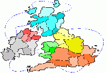
 ✕ 🏳 Countries · Created by: Soldadito de Plomo British IslandsEngland, the most populous nation of the United Kingdom with 56 million inhabitants, is divided into 47 ceremonial counties that inherit a territorial organization with medieval roots, although the last major reform dates back to 1965 with the creation of Greater London. Yorkshire is the largest county, covering almost 15,000 square kilometers and including cities such as Leeds, Sheffield, and York, while historic counties such as Lancashire, Northumberland, and Cornwall continue to mark recognizable cultural and dialectal boundaries. The division between the industrial north and rural south, or between the Midlands and the Home Counties, reflects economic and demographic differences that have shaped British politics for centuries. On this Risk map, the north with its valleys and Pennines is a natural defensive zone, the Midlands are the central corridor connecting with Scotland and Wales, and the south with London is the strategic prize due to its density and connections with the English Channel. Controlling the coastal counties in the east and south gives you access to maritime routes toward continental Europe, while northern ports such as Newcastle and Liverpool are historic naval invasion points. ⚔ Your next conquest starts hereLog in with your account or sign up for free to play on this map and over 100 more Play nowI don´t have an account yet, I want to sign up✕ |